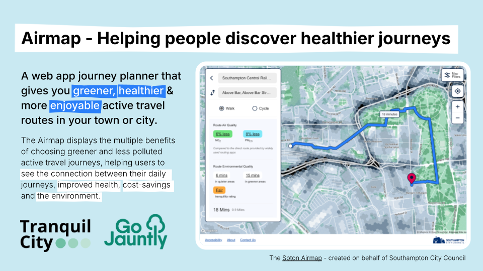
Airmap
A web app journey planner that offers greener, healthier, and more enjoyable walking and cycling routes.
The Airmap displays the multiple benefits of choosing active travel journeys that avoid air pollution and increase access to nature. It helps users to see the connection between their daily journeys and improved health and the environment.
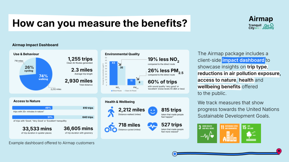
Tranquil City creates and collates environmental map layers including high-resolution air pollution and tranquillity maps to incorporate into the Go Jauntly routing algorithm. Benefits are calculated to show users a reduction in air pollution (NO2 and PM2.5) exposure, improvements in sound quality, minutes spent in quiet, and minutes spent in nature.


By commissioning the Airmap you will get:
- A public-facing web app helping people discover healthier active travel journeys
- High-resolution map layers of air quality, green infrastructure & tranquillity maps
- A Walkshop launch event with the public & other stakeholders
- Live impact dashboard that shows impact towards policy aims & SDGs
The tool can help Local Authorities progress their policy aims of reducing pollution exposure, improving air quality and providing improved active travel opportunities. This supports wider DfT, DEFRA and DHSC objectives for sustainable transport, health and environmental quality.
Testimonials
“Tranquil City created the Soton Airmap that enables residents in Southampton to find clean air, more tranquil and greener routes around the city. Grant and the team completed this project to a very high standard and took on board feedback to make this tool user-friendly and accessibility compliant. Working with Tranquil City, and their partner in this project Go Jauntly, was easy and the passion and energy they put into making this project successful was brilliant.”
Amber Titchener, Air Quality Officer, Southampton City Council